Excavations in Bath demand meticulous planning due to the city’s complex geology, dominated by the Great Oolite limestone overlying Lias Clay. Our category addresses the full lifecycle of subsurface works, from initial geotechnical analysis for soft soil tunnels through to execution, ensuring compliance with UK standards including BS 6164 and CDM Regulations. The transition between competent rock and weaker ground requires careful assessment, which we manage through targeted geotechnical design of deep excavations to control settlement risks near Bath’s historic structures.
Typical applications include service tunnels, basement construction for Georgian property renovations, and infrastructure upgrades within the city’s UNESCO World Heritage setting. These projects consistently rely on geotechnical excavation monitoring to validate design assumptions and protect adjacent assets. Our integrated approach supports contractors and consultants in managing ground movement and groundwater control throughout construction.
Anchor design in Bath is a negotiation between the stiff limestone that provides excellent bond and the creeping Lias Clay that demands conservative free-length detailing.
Service characteristics in Bath
Critical ground factors in Bath
Bath's combination of steep valley sides, centuries-old retaining walls, and variable groundwater chemistry creates anchor design risks that are easy to underestimate. Thermal spring water carries dissolved sulphates and carbonates that accelerate steel corrosion—selecting the wrong protection class here means tendon failure within a decade. Overconsolidated Lias Clay exhibits time-dependent creep; passive anchors designed without allowance for relaxation can lose 20–30% of their load capacity within the first five years. The proximity of listed buildings on shallow strip footings demands that anchor installation methods be low-vibration and that grout pressures be limited to avoid heave beneath historic masonry. On sites within the Bath World Heritage Site boundary, visual impact restrictions may dictate flush anchor heads and recessed bearing plates. Each of these factors—corrosion, creep, vibration limits, aesthetic constraints—must be addressed explicitly in the design documentation submitted for building control approval under the Bath & North East Somerset Council.
Our services
Anchor design services in Bath span temporary excavation support for basement construction to permanent retention of highway cuttings. The three core service packages below cover the typical project spectrum encountered across the city's varied geology.
Active anchor design for deep excavations
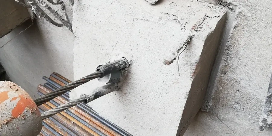
Prestressed strand or bar anchors for basement excavations and retaining walls where lateral displacement must be minimised to protect adjacent structures. Includes staged stressing sequences and locked-off load verification per BS EN 1537.
Passive anchor and soil nail design
Self-drilling and hollow bar passive anchors for slope stabilisation in Lias Clay cuttings and embankment reinforcement. Design accounts for creep relaxation in overconsolidated soils and long-term bond degradation in weathered zones.
Anchor corrosion protection and durability assessment
Protection class selection (I or II) based on site-specific groundwater chemistry analysis. Particularly relevant near the Bath thermal springs, where sulphate and chloride levels exceed typical UK groundwater values and drive the need for double corrosion protection systems.
Excavations in Bath demand a rigorous understanding of the complex geological conditions beneath this historic city, where the renowned Bath Stone oolite is interbedded with layers of Fuller’s Earth and Lias Clay. Our approach begins with a comprehensive investigation to delineate the depth, weathering grade, and structural integrity of the limestone, alongside identifying potential karstic features and groundwater pathways that could compromise excavation stability. Compliance with UK standards, particularly BS 5930:2015+A1:2020 for ground investigation and BS EN 1997-2 for geotechnical design, governs every phase of data acquisition, ensuring that the design of temporary works and permanent linings is founded on reliable ground parameters.
Our methodology integrates advanced in-situ techniques to capture a full geotechnical profile without disturbing the sensitive urban fabric of Bath. The Cone Penetration Test (CPT) provides continuous stratigraphic data in overburden soils, while targeted In-Situ such as pressuremeter tests in boreholes yields deformation moduli critical for predicting ground movements adjacent to heritage structures. For precise control of backfill and compaction in utility trenches or cut-and-cover works, we employ the field density test (sand cone method) in accordance with BS 1377-9:1990, verifying compliance with specified relative compaction values. These field programmes are designed to minimise surface disruption whilst extracting the maximum information value, a necessity when working within the UNESCO World Heritage Site constraints.
Typical projects in Bath range from basement extensions beneath Grade II listed Georgian crescents to tunnelling for infrastructure upgrades through the Great Oolite Group. The variable presence of the Midford Sands at the limestone interface often dictates excavation sequencing and groundwater control measures. A detailed grain size analysis (sieve + hydrometer) of these transitional soils, combined with Atterberg limits on the clay horizons, refines the assessment of liquefaction potential and face stability. All recovered samples undergo a full suite of laboratory testing, including uniaxial compressive strength tests on rock cores to classify the Bath Stone for rippability and stand-up time assessments, directly informing the selection of roadheader or drill-and-blast methods.
The process delivers a fully integrated interpretative report, presenting factual geotechnical data alongside a ground model that informs the excavation and support design. Deliverables include cross-sections mapping the oolite-limestone-shale succession, parameter derivation for numerical modelling, and clear recommendations for depressurisation and grouting strategies where fractures are open. Our value proposition is the delivery of excavation-ready knowledge, de-risking your project by combining local geological insight with strict adherence to UK normative frameworks, ensuring that your underground space in Bath is constructed safely, efficiently, and with full respect for the built heritage above.