With Bath sitting in the deep Avon Valley, elevation varies abruptly from about 20 m near the river to over 200 m on the surrounding plateaus — a topographic squeeze that masks an even more dramatic geological mix. You get Great Oolite limestone on the high ground, weathered Fuller’s Earth on the slopes, and recent alluvium plus river terrace gravels down in the floodplain. A grain size analysis (sieve + hydrometer) becomes essential for any project straddling these transitions, because a foundation design calibrated for gravelly terrace deposits fails completely if the excavation hits a silty clay lens three metres further east. Our lab runs the full BS 1377-2:1990 procedure — dry and wet sieving down to 63 µm, then hydrometer sedimentation for the fines fraction — so the grading curve captures everything from cobbles to colloidal clay. For road subgrades on the A4 corridor where Bath stone spoil is common, we often pair the particle-size distribution with a CBR assessment to anticipate long-term performance under traffic loading.
A single grading curve from our Bath lab resolves the difference between free-draining oolitic gravel and a moisture-sensitive silty clay — the difference between a straightforward footing and an expensive over-excavation.
Service characteristics in Bath
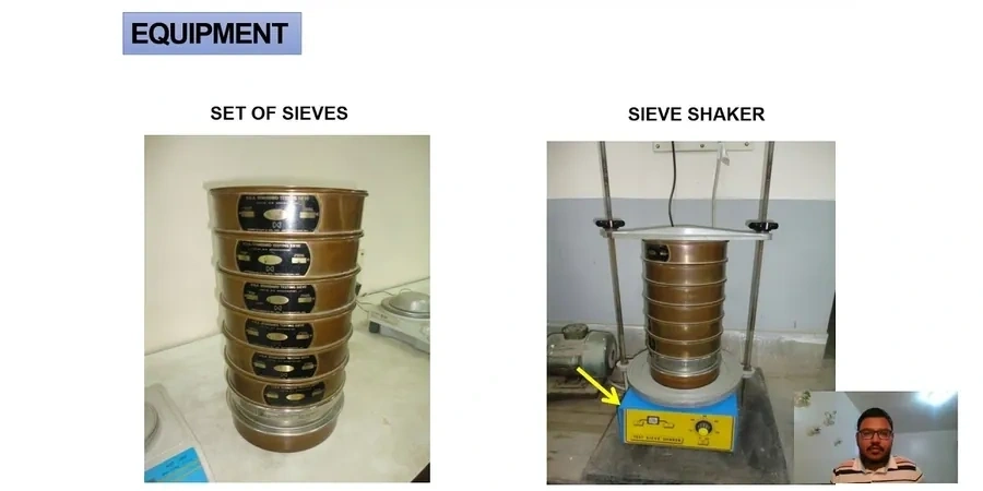
- Mechanical sieving: 75 mm to 63 µm, dry or washed depending on fines content
- Hydrometer analysis: ASTM 152H hydrometer, 24-hour sedimentation with dispersant
- Reporting: full particle-size distribution curve, D10-D30-D60, Cu, Cc, and USCS/BS classification
Critical ground factors in Bath
BS EN 1997-2:2007 (Eurocode 7 — Ground investigation and testing) requires that the particle-size distribution be established with sufficient resolution to assign a reliable soil description and design parameter set; skipping the hydrometer step when fines exceed 10 % puts the ground model in breach of that requirement. In Bath, the risk concentrates on the valley-floor alluvium and the clay-rich members of the Charmouth Mudstone and Fuller’s Earth formations, where silt and clay bands can go unnoticed in a visual log. A sand that looks clean at the trench face may still carry 20 % fines — enough to halve the permeability and trap pore pressure behind a retaining wall. The hydrometer analysis picks up that signature. For excavations near the Avon, where groundwater levels fluctuate with the river stage, the grading curve also feeds directly into the seepage assessment required by BS 8004:2015 for temporary works design, and missing the clay fraction can lead to an under-designed dewatering system that fails mid-construction.
Our services
Our Bath laboratory handles the full workflow from sample receipt to certified report, so the grading data is integrated with the rest of the ground investigation rather than treated as an isolated index test. The three service levels below cover the most common project needs in the city.
Standard sieve analysis (coarse + fine)
Dry sieving for granular soils with < 10 % fines, covering the 75 mm to 63 µm range. Suitable for free-draining oolitic gravels and river terrace deposits encountered across Bath’s valley floor developments.
Combined sieve + hydrometer package
Wet sieving followed by 24-hour hydrometer sedimentation for soils with > 10 % fines. Essential for the silty clays of the Fuller’s Earth and the weathered mudstone horizons on the Lansdown slopes.
Interpretative grading report with classification
Full particle-size distribution curve plotted against BS 5930 grading limits, plus USCS or BS classification, Cu and Cc coefficients, and commentary on likely permeability and frost susceptibility for earthworks specification.
Quick answers
When does a project in Bath need the hydrometer analysis, not just sieving?
The hydrometer step becomes necessary whenever the fines content — material passing the 63 µm sieve — exceeds about 10 %. In Bath, this threshold is routinely crossed in the Fuller’s Earth clay, Charmouth Mudstone weathered zones, and the silty alluvium along the Avon corridor. BS EN 1997-2 requires the full grading curve down to the clay fraction for any soil that will influence foundation settlement, earthworks compaction, or drainage design; relying on sieve-only data in those formations leaves the ground model incomplete and can lead to misclassification of the soil behaviour type.
How much does a grain size analysis with hydrometer cost for a Bath project?
For a combined sieve-and-hydrometer test compliant with BS 1377-2, the price typically ranges from £80 to £140 per sample, depending on whether the material requires pre-treatment for organic content or carbonate cementation — both common in the Bath area due to limestone-derived soils and historic lime-mortar fill. A sieve-only analysis sits at the lower end of that bracket. The final cost also reflects the number of samples and the turnaround time required.
What sample size do you need for a representative grading curve?
It depends on the maximum particle size. BS 1377-2 sets minimum sample masses: for a soil with a Dmax of 20 mm, around 2 kg is sufficient; if the material contains cobbles up to 75 mm, the lab needs 25–50 kg to avoid bias. For the Bath river terrace gravels, which often contain 40–60 mm sub-rounded limestone clasts, we typically request a 10–15 kg bulk sample bagged from a trial pit or window sampler run.
How does the hydrometer test differentiate between silt and clay?
The hydrometer measures the density of the soil-water suspension at timed intervals as particles settle according to Stokes’ law — coarser silt drops out within the first few minutes, while clay particles remain in suspension for hours. In our Bath lab we take readings at 0.5, 1, 2, 4, 8, 15, 30, 60, 120, 240, and 1440 minutes, with a temperature correction applied per BS 1377-2. The resulting curve distinguishes the silt fraction (63–2 µm) from the clay fraction (< 2 µm), which is critical for assessing plasticity and shrink-swell potential in the Lias Clay and Fuller’s Earth formations that underlie much of central Bath.