Standing at 230 metres on Lansdown overlooking Bath, the city's geology is rarely as solid as its Georgian crescents suggest. The Great Oolite limestone that built the Royal Crescent also conceals solution features, clay-filled fissures, and variable groundwater that can turn a straightforward foundation dig into a costly delay. Over the past decade our team has run more than sixty resistivity lines across the city basin, from the river terraces near Pulteney Bridge to the slopes of Combe Down. An electrical resistivity survey maps these subsurface contrasts without breaking ground, using arrays of electrodes to measure how easily current passes through the strata below. For deeper profiling we run Vertical Electrical Sounding surveys that resolve layer boundaries at depths exceeding 30 metres, complementing seismic refraction campaigns where the limestone is heavily fractured and velocity contrasts are subtle.
Within Bath's World Heritage boundary, resistivity surveys deliver the subsurface certainty that trial pits alone cannot, without disturbing archaeology or listed landscapes.
Service characteristics in Bath
Critical ground factors in Bath
We were called to a mews conversion off Great Pulteney Street where the contractor had uncovered a 2-metre void during piling. The developer assumed a single swallow hole; the resistivity survey revealed three interconnected cavities within the oolite, one running beneath the neighbouring Grade II listed wall. Without that geophysical picture the grouting programme would have under-treated the ground, and movement in the adjacent structure would have triggered a costly party wall claim. In Bath's hillside settings the bigger hazard is perched water: a clay band within the limestone can hold a saturated lens that saturates the overburden after heavy rain. Resistivity profiling across the slope identifies these lenses before excavation destabilises them. The cost of ignoring a karst feature under a foundation pad in central Bath routinely exceeds fifty times the survey budget, and the disruption to a protected streetscape is measured in months of hand-digging and archaeological watching briefs.
Our services
Every resistivity campaign we deliver in Bath starts with a desk study of the British Geological Survey 1:10,000 mapping, because the city straddles three distinct formations within a kilometre. The survey design then targets the specific question the engineer needs answered, whether that is depth to competent limestone, continuity of clay bands, or detection of dissolution features.
2D Electrical Resistivity Tomography (ERT)
Multi-electrode profiles that produce continuous cross-sections of subsurface resistivity. Ideal for mapping the limestone–clay interface along proposed retaining wall alignments or road widening corridors in Bath's constrained valley setting.
Vertical Electrical Sounding (VES)
Deep one-dimensional soundings using expanding electrode spreads to resolve layer thicknesses and resistivities at depths beyond 40 metres. Used routinely for tower crane base design and deep basement feasibility studies in the city centre.
Karst & Void Detection Surveys
Gridded 2D lines combined with 3D inversion to delineate dissolution features within the Great Oolite and Inferior Oolite formations. Delivered as geo-referenced depth slices that guide targeted drilling and grouting programmes.
Groundwater & Leakage Mapping
Resistivity surveys configured to track preferential flow paths through fractured limestone and identify zones of perched saturation on hillside sites. Frequently requested for basement waterproofing design in Bath's Georgian terraces.
Quick answers
Can resistivity surveys be run inside Bath's World Heritage Site without damaging archaeology?
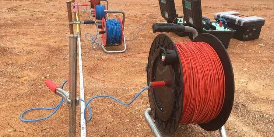
Absolutely. The entire method is surface-based and non-intrusive. We lay stainless steel electrodes at the ground surface, typically with 1–2 metre spacing, and pass a very low-amplitude current between them. There is no excavation, no vibration, and no lasting trace once the electrodes are removed. This makes resistivity the preferred technique for sites within the conservation area where trial pits or boreholes would require archaeological supervision and listed-building consent.
What does a typical resistivity survey cost for a single residential plot in Bath?
For a single-building plot in the Bath area, a 2D resistivity profile with VES soundings typically falls between £480 and £900 depending on the line length, electrode spacing, and whether we need to combine multiple arrays to resolve both shallow and deep features. Larger commercial surveys with gridded lines and 3D inversion are scoped and quoted individually after reviewing the BGS mapping and the engineer's specific questions.
How deep can VES soundings reach in Bath's limestone geology?
In the Great Oolite limestone that underlies much of central Bath, we routinely achieve effective penetration to 40–60 metres below ground level using a Schlumberger expanding array. The key variable is the resistivity contrast between layers: the limestone-to-clay boundary produces a strong response that resolves cleanly, while subtler transitions within the limestone sequence may require longer spreads and supplementary seismic refraction to confirm the interpretation.